
Agrophysics is the application of physics to agronomy, which is the study of agricultural sciences. Both agronomy and agricultural science are interdisciplinary fields that involve multiple scientific disciplines. Agrophysics is essentially the cross-pollination of physics and agronomy. The history of agrophysics dates back to at least the early 1800s when several prominent scientists began empirically researching agricultural practices using principles from physics and chemistry. Agrometeorology, a branch of agrophysics, studies the weather patterns that directly impact crop growth and yields by analyzing atmospheric phenomena such as temperature, humidity, precipitation, solar radiation, wind speed and direction, ultraviolet rays, and other environmental factors that influence agriculture. These sub-fields of agrophysics are discussed in further detail below.
Early developments in agrophysics
The earliest developments in the field of agrophysics occurred in the mid to late 1800s when several prominent scientists began empirically researching agricultural practices using principles from physics and chemistry. One such scientist was Thomas Samuel Malthus, an English economist and scholar who wrote: “An Essay on the Principle of Population, as it Affects the Future Improvement of Society.” Published in 1798, this essay became the foundation for population control and agricultural policy. Malthus’s essay prompted social scientists and policymakers to better understand how food supply and human population growth are related. These groups of people eventually began to study agricultural practices empirically, applying scientific principles such as chemistry and physics to agronomy research. Another scientist who contributed to the early developments of agrophysics was Justus von Liebig, a German chemist, and professor at the University of Giessen. In the mid-1800s, Liebig published a series of essays on how chemistry affects agriculture. These essays formed the foundation of modern agricultural chemistry. Liebig’s research on agricultural practices led to discoveries in the fields of soil chemistry, fertilization, and plant nutrition. He also developed a general understanding of the human-soil-plant relationship and the effect of atmospheric conditions on plant growth.
Basics of agrophysics
Agrophysics is the application of physics to agronomy, which is the study of agricultural sciences. Both agronomy and agricultural science are interdisciplinary fields that involve multiple scientific disciplines. Agrophysics is essentially the cross-pollination of physics and agronomy. The following paragraphs describe the various sub-fields of agrophysics. Agrometeorology, also known as agricultural meteorology, is the study of weather patterns that directly impact crop growth and yields by analyzing atmospheric phenomena such as temperature, humidity, precipitation, solar radiation, wind speed and direction, ultraviolet rays, and other environmental factors that influence agriculture. Agronomy is the application of soil science, plant science, genetics, and nutritional science to agricultural practices. Its general aim is to sustain the health of soil, plants, and animals in an agricultural setting. Agronomic practices depend on the climate, but also on the plants, animals, and ecosystems that are studied. Meteorology is an important sub-discipline of agronomy that studies the climate and weather conditions that influence plant growth and development. Agricultural physics applies the laws of physics to agricultural practices. It is the study of the physical properties of soils, plants, water, and other factors related to the production of food, fiber, and other agricultural products. Agricultural physicists study the flow of water and air through the soil, plant growth, the effects of various gases, and the impact of radiation on plants. Agricultural biophysics is the application of the laws of physics to biological organisms such as humans, plants, and animals. Agricultural biophysicists research the effects of light, sound, and other forms of energy on biological systems.
Agrometeorology
Agrometeorology, also known as agricultural meteorology, is the study of weather patterns that directly impact crop growth and yields by analyzing atmospheric phenomena such as temperature, humidity, precipitation, solar radiation, wind speed and direction, ultraviolet rays, and other environmental factors that influence agriculture. It is the sub-field of agrophysics that studies the relationship between weather patterns and crop growth and yields. Agrometeorologists use several types of data, including weather observations, satellite images, and computer models, to forecast weather patterns that may impact crop growth and yields. The data they collect and forecast is used by farmers and agricultural corporations to monitor and manage crops that are in production. Agrometeorologists can work for federal and state government agencies, private firms, and academia. Many of them work for the National Aeronautics and Space Administration (NASA), which uses satellites to collect data about weather patterns globally. Agrometeorologists are responsible for collecting data about soil and water conditions, crop development, and weather patterns. They use this information to forecast future weather conditions and make recommendations to farmers about planting dates, crop rotations, irrigation, and harvesting cycles.
Remote sensing and satellite remote sensing
Remote sensing is the process of detecting and analyzing materials with the help of electromagnetic waves that do not interact with the source of the waves. It is used in many disciplines, including space sciences, astronomy, environmental sciences, hydrology, agriculture, and ecology. In agriculture, remote sensing is used to determine land use, crop yields, crop health, and soil quality. Remote sensing is also used to monitor and forecast weather patterns that may impact crop growth and yields. Remote sensing is often used in conjunction with satellite imagery. The data collected by satellites are used to study the environment and are frequently displayed as images.
Digital soil mapping
Soil scientists use a variety of techniques to study soil and identify its properties. Modern soil scientists collect data using computers, sensors, and robots. Traditionally, soil scientists have used visual and tactile methods to assess soil properties. The process of mapping soils digitally began in the early 1960s with the federal government’s Soil Conservation Service (SCS). This government agency was tasked with mapping the nation’s soils to assist farmers and landowners in managing their agricultural lands. The SCS used remote sensing and computer technology to create “ Decision Support System for Crop Management” (DSS) models to help farmers make crop management decisions. The SCS distributed the soil maps to local farmers through what were called Soil Conservation Districts (SCDs). These CDs were local offices that provided information and support to farmers in their regions. Farmers could use these soil maps to make decisions about planting crops and managing their land.
Conclusion
The history of agrophysics dates back to at least the early 1800s when several prominent scientists began empirically researching agricultural practices using principles from physics and chemistry. As technology and scientific methods have advanced, agrophysics has advanced along with it. Advancements in remote sensing and satellite imagery have helped soil scientists study soil properties using images collected by satellites. Advances in computer technology have helped soil scientists collect and analyze data. As advances in agrophysics continue to be made, researchers hope that farmers will use this data to make better crop management decisions.

 9 AI-Based Apps to Improve Your Mental Health and Well-being
 Android and Samsung Galaxy S22 Ultra
 How to Invest in Cryptocurrencies: A Beginner's Guide
 What is the Study of Enzymology?
 The Study of Anthropology in Science
 Oceanography is an Important Branch of Science
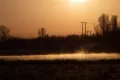 A Short Description of Paleontology